image-1.png

Hospital Wayfinding Isn’t a Convenience — It’s a Patient Safety Metric

Hospital Wayfinding Is a Patient Safety Metric, Not a Convenience

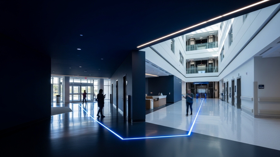
A visitor arrives at a hospital already anxious about a loved one. Ten minutes later, they are lost, late, and more stressed than when they walked in. That moment may look like a signage issue. In practice, it shapes patient experience, strains operations, and introduces avoidable safety risk.

Recent research on IoT-enabled wayfinding, including a widely cited 2025 ScienceDirect study, points to the same conclusion echoed in newer clinical-operations thinking in Frontiers in Medical Technology: navigation friction is measurable. It can be reduced, managed, and tied to outcomes executives already care about. That makes hospital wayfinding part of patient safety and quality performance, not a cosmetic facilities upgrade.

Why hospital wayfinding belongs in quality and safety discussions

Hospitals already track proxies that reveal the real experience of care: time-to-triage, falls, readmissions, and call-light response. Hospital wayfinding deserves similar attention. When patients and families spend the first part of a visit searching for the right building, entrance, or department, delays spread quickly.

Late arrivals disrupt imaging schedules, congest lobbies, force rushed check-ins, and pull frontline staff away from clinical work to give directions. What starts as confusion at the curb often ends as friction across the visit.

The safety implications are easy to underestimate. Stress narrows attention and weakens comprehension. That matters when people need to follow instructions about medication changes, consent, discharge, or next steps in care. Hospital wayfinding patient safety is not an abstract concept; it is about reducing preventable errors created by disorientation.

What digital wayfinding data shows in hospitals

The 2025 ScienceDirect IoT wayfinding study offers something patient-experience debates rarely get: hard usability data. Reported outcomes were striking. 85% found the system easy to use, 87% said it reduced navigation time, 94% preferred digital wayfinding over signage, and 100% said they would recommend it.

Those numbers matter because they shift the conversation from opinion to operations. If most users navigate faster and prefer digital guidance to static signs, then wayfinding is no longer just an environmental design issue. It becomes a controllable variable in access, flow, and satisfaction.

The same logic appears in Frontiers in Medical Technology, which argues that indoor navigation should be treated as part of the hospital’s socio-technical safety system rather than a standalone app. That framing is useful. Hospitals do not run on signs alone; they run on systems that help people move, decide, and act under stress.

Featured snippet: Does hospital wayfinding affect HCAHPS scores?

Yes. Hospital wayfinding affects satisfaction because navigation problems raise stress, delay arrivals, and worsen first impressions. In recent research, 94% preferred digital wayfinding to signage and 87% said it reduced navigation time. Those gains can influence experience measures that often surface in HCAHPS feedback and patient comments.

Why static signage often fails in complex care environments

Hospitals change constantly. Clinics move, names change, wings expand, and temporary routes become permanent. Static signage struggles to keep up. Even when signs are technically correct, they still compete with cognitive overload, unfamiliar terminology, language barriers, and the sheer scale of large campuses.

That is why adding more signs often produces diminishing returns. More information does not always create more clarity. Digital navigation for hospital visitors works differently: it updates centrally, responds to live destinations, and guides each person along the route they need at that moment.

SMS-based, bilingual guidance removes friction at the point of need

Hospitals do not need to force every visitor to download an app to improve wayfinding. SMS-based navigation is a practical design choice because it works on nearly any phone and starts immediately. A hospital can trigger it through appointment reminders, QR codes at entrances, or links in pre-visit instructions.

That low-friction model matters because adoption is often the hidden failure point in digital tools. The best route guidance delivers little value if users must first install software, create an account, or learn a new interface while under pressure.

Language support matters just as much. Multilingual, turn-by-turn guidance is not a convenience feature; it improves comprehension and throughput. It reduces reliance on improvised interpretation at information desks and lowers the burden on nursing units that should not operate as backup concierge teams.

For leaders asking how to improve HCAHPS with digital maps, this is one of the clearest mechanisms: fewer confused arrivals, fewer tense interactions, and fewer late starts that shape the entire visit before care even begins.

Parking is often the first wayfinding failure point

Wayfinding problems usually start before anyone reaches the lobby. Visitors circle lots, choose a spot that seems close enough, and later struggle to remember where they parked. When 35% forget their parking location, stress follows them into the building and often returns on the way out.

That matters more than it seems. Families leaving an appointment may be processing discharge instructions, test results, or bad news. A frustrating search for the car is not separate from the care experience; it is part of it.

Strong digital wayfinding treats parking as part of the journey: where to park, which zone to remember, which entrance best matches the destination, and which route is accessible. That reduces late arrivals and keeps staff from becoming the hospital’s default navigation layer.

What scaled deployment looks like in practice

Some hospitals have already moved beyond pilot programs. In the GCC, indoor navigation platforms now support routine patient and visitor movement at scale. Veenux, for example, has been deployed in environments including Johns Hopkins Aramco Healthcare and NMC Healthcare, using SMS-triggered indoor navigation to guide people from parking to the appointment room with multilingual maps.

The broader lesson is not vendor-specific. Adoption improves when navigation tools meet people where they already are: on their phones, in their language, and with directions tied to an exact destination rather than a generic building map.

What hospitals should measure next

If hospital wayfinding is going to be managed like a quality program, it needs operational metrics. Start with indicators leadership already recognizes: late-arrival rates, appointment reschedules, lobby congestion, interpreter use for non-clinical questions, and the volume of calls or desk interactions that are simply requests for directions.

Then connect those signals to survey comments and patient-experience data. If the question is whether hospital wayfinding affects patient satisfaction scores, the answer will usually appear in the correlation between early navigation failures and complaint patterns, abandoned visits, or negative comments about the visit before care even began.

Hospitals cannot remove the anxiety that patients and families bring with them. They can remove avoidable confusion. That makes wayfinding one of the few experience variables that is both high-impact and fixable—with consequences for safety, throughput, and trust.

To explore how digital wayfinding fits into hospital operations, visit veenux.com.
indoor map

What Are Indoor Maps? A Complete Guide to Digital Wayfinding for Airports, Hospitals, Universities, and Malls

Most people can navigate to any building on earth in seconds using GPS. But the moment they walk through the front door, they’re on their own — and 53% of them get lost.

That gap between outdoor GPS and indoor navigation is one of the most expensive experience failures in modern buildings. Indoor maps exist to close it. And in 2026, they’ve moved from a novelty to a necessity.

This guide explains what indoor maps are, how indoor navigation technology works, why it matters for different venues, and the best practices that separate effective digital wayfinding from wasted investment.


What Is an Indoor Map?

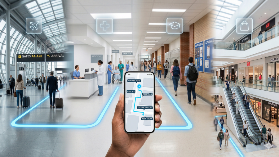
Q: What is an indoor map and how does it work? A: An indoor map is a digital, interactive representation of a building’s interior — including floors, rooms, corridors, elevators, and points of interest — that allows visitors to search for destinations and receive turn-by-turn navigation directions indoors, where GPS doesn’t work. Indoor maps use technologies like Bluetooth Low Energy (BLE) beacons, Wi-Fi positioning, or Ultra-Wideband (UWB) to determine a visitor’s real-time location inside the building.

Unlike static paper directories or fixed signage, indoor maps are dynamic. They update in real time, support multiple languages, provide accessible routing for wheelchair users, and deliver data back to venue operators on how visitors move through the space.


Why Do Buildings Need Indoor Maps in 2026?

Q: Why are indoor maps important for large venues? A: Because 53% of venue visitors experience navigation problems, 77% already use digital tools to find their way, and only 23% still rely on physical signage. For airports, hospitals, universities, and malls, poor indoor navigation directly increases visitor stress, reduces dwell time, lowers satisfaction scores, and costs revenue.

These numbers come from Mappedin’s 2026 State of Venue Experience report, which surveyed nearly 500 venue visitors across North America. The findings confirmed that digital wayfinding adoption now spans every age group from 18 to 60+ — this isn’t a generational preference. It’s a baseline expectation.

For venue operators, the business case is straightforward: every minute a visitor spends lost is a minute they’re not shopping, dining, attending appointments, or engaging with the space.


How Does Indoor Navigation Technology Work?

Indoor maps combine three technology layers to guide visitors inside buildings where GPS signals can’t reach.

Q: How does indoor positioning work without GPS? A: Indoor positioning uses local wireless technologies — BLE beacons, Wi-Fi access points, or UWB sensors — installed inside buildings to determine a visitor’s location. The visitor’s smartphone detects these signals, and the indoor map platform calculates their position and displays it as a “blue dot” on the digital floor plan, similar to the blue dot in outdoor navigation apps.

The map layer is a detailed digital floor plan converted from CAD or BIM architectural files. It represents every floor, corridor, staircase, elevator, restroom, and point of interest. The best implementations are interactive — visitors can pan, zoom, rotate, and switch between floors.

The positioning layer determines where the visitor is inside the building using BLE, Wi-Fi, or UWB signals. BLE beacons are the most common choice for their low cost and scalability. UWB provides centimeter-level accuracy for environments that need precision, like hospitals tracking equipment.

The routing layer calculates the shortest or most accessible path from the visitor’s current location to their searched destination, delivering step-by-step directions that account for elevators, stairs, restricted zones, and wheelchair-accessible routes.


What Are the Benefits of Indoor Maps for Visitors?

Q: What are the main benefits of digital indoor maps for visitors? A: Indoor maps reduce navigation time, lower visitor stress and anxiety, support multilingual and accessible wayfinding, enable discovery of amenities and services, and eliminate dependence on staff for directions. Studies show 87% of users reported reduced navigation time and 94% preferred digital wayfinding over traditional signage.

Those results come from a peer-reviewed ScienceDirect study on IoT-based hospital wayfinding, where 100% of surveyed users said they would recommend the digital system to others. The psychological benefit is significant — 83% of users reported reduced stress from navigation, which matters enormously in high-anxiety environments like hospitals and airports.

For venue operators, the benefits mirror the visitor side: fewer repetitive directional queries for staff, higher retail and F&B engagement, improved satisfaction metrics, and actionable data on how visitors actually use the space.


Best Practices for Indoor Maps in Airports

Q: How do airports use indoor maps to improve passenger experience? A: Airports deploy indoor maps through QR codes at terminal touchpoints — arrivals, security exits, gate areas, and parking — giving passengers instant browser-based navigation without app downloads. Leading airports integrate wayfinding with flight information systems so passengers can search by flight number and get routed directly to their gate.

Effective airport wayfinding also connects navigation to retail and dining discovery. Mappedin’s research shows 50% of venue visits are discovery-oriented — passengers will browse and spend if they can easily see what’s nearby on their route. When a traveler sees a coffee shop is 90 seconds away and on the way to their gate, they’re far more likely to stop.

Additional airport best practices include providing accessible routing for passengers with reduced mobility, supporting multilingual navigation for international travelers, and integrating wayfinding with digital signage so screens display contextual directions based on location and time.


Best Practices for Indoor Maps in Hospitals

Q: How do hospitals use indoor maps to improve patient experience? A: Hospitals deploy indoor maps through SMS or QR-triggered navigation starting at check-in — sending patients a link with directions to their specific appointment room. This approach reduces the most common hospital navigation failures: visitors getting lost within ten minutes of arrival and 35% forgetting where they parked.

Hospital wayfinding requires special attention to emotional design. Visitors arrive under stress, and complex multi-building layouts compound anxiety. Best practices include enabling department-level search (“Cardiology,” “Lab,” “Emergency”) instead of room numbers alone, supporting multilingual navigation for diverse patient populations, and integrating parking lot wayfinding so visitors can find their car when leaving.

Connecting indoor maps to patient satisfaction metrics like HCAHPS scores makes the business case concrete — visitor navigation experience directly influences survey responses, hospital ratings, and reimbursement.


Best Practices for Indoor Maps on University Campuses

Q: How do universities use indoor maps to help students navigate campus? A: Universities deploy indoor maps through QR codes on orientation materials, building entrances, and campus posters — giving new students instant navigation on their first day without downloading an app. Research ranks “findability” as the number-one priority for campus users, ahead of advanced technologies like VR and robotics.

Campus wayfinding serves two distinct audiences. New visitors — prospective students, parents, and event attendees — need immediate orientation and building-level guidance. Daily users — students, faculty, and staff — need ongoing utility like real-time room availability, study space finders, and event location guidance.

Best practices include building a room-finder feature that shows live availability, integrating campus maps with academic calendars and event schedules, providing accessibility routing across outdoor paths and between buildings, and using the map platform as the foundation for smart campus initiatives like occupancy-based energy management and space utilization analytics.


Best Practices for Indoor Maps in Shopping Malls

Q: How do shopping malls use indoor maps to increase visitor engagement and revenue? A: Malls deploy indoor maps as discovery engines — not just directories. Beyond search and navigation, effective mall maps surface promotions, events, new store openings, and dining options within the map interface. This converts the 50% of visitors who arrive without a specific destination into active browsers and spenders.

Navigation friction has a direct revenue impact: every minute a shopper spends searching for a store is a minute they’re not browsing, eating, or making impulse purchases. PwC research indicates 78% of Gen Z and millennial mall visitors prefer digital wayfinding solutions over asking for directions or using static maps.

Mall best practices include deploying maps on both kiosks and mobile via QR codes, providing tenant-level search with open hours and category filters, integrating wayfinding with loyalty programs and promotional notifications, and feeding foot traffic analytics back to leasing teams to optimize tenant mix and layout decisions.


What Are the Universal Best Practices for Indoor Maps?

Regardless of venue type, five principles separate indoor maps that work from indoor maps that get ignored.

Q: What makes a good indoor map solution? A: The best indoor map solutions share five characteristics: zero-friction access (QR-to-browser, no app download), real-time accuracy (instant updates when rooms or stores change), multilingual and accessible design, data feedback to operators (foot traffic, search queries, dwell time), and cross-platform consistency (same map on phone, kiosk, and website).

Zero-friction access is non-negotiable. If visitors must download an app, create an account, or wait for a kiosk queue, adoption drops below 5%. The most effective approach is QR-to-browser: a visitor scans a code and gets a full interactive map in their phone’s browser within three seconds. No app store. No login.

Real-time accuracy means the map connects to a content management system where operators can update points of interest, routes, store names, department locations, and operating hours instantly. A map that shows a closed store or a moved department is worse than no map at all.

Multilingual and accessible design supports screen readers, wheelchair-friendly routing, and multiple languages — essential for any public-facing venue serving diverse populations.

Data that flows back to operators transforms indoor maps from a visitor tool into a strategic asset. Foot traffic heatmaps, popular search queries, navigation drop-off points, and dwell time patterns inform decisions about staffing, layout, tenant mix, and capital planning.

Cross-platform consistency ensures the same map, data, and experience appear whether a visitor accesses it on their smartphone, a lobby kiosk, the venue’s website, or an embedded widget in a partner app.


How Big Is the Indoor Mapping Market in 2026?

Q: What is the size of the indoor positioning and mapping market? A: The global indoor location market is projected at $21.46 billion in 2026, growing at a 23.6% compound annual growth rate, with healthcare, retail, airports, and smart buildings as the primary adoption verticals. It’s expected to reach $44.14 billion by 2030.

This growth is driven by the convergence of several forces: BLE beacon costs have dropped significantly, making large-scale deployment affordable. Smartphone penetration provides a universal visitor interface. And venue operators increasingly recognize that indoor data — foot traffic, occupancy, flow patterns — is as strategically valuable as the navigation experience itself.


How to Choose an Indoor Map Platform

For venue operators evaluating indoor mapping solutions, the decision comes down to five factors: deployment speed, visitor friction, venue versatility, data capabilities, and total cost of ownership.

Platforms like Veenux are built to address all five. Veenux delivers QR-based indoor maps that work in any browser with no app download, BLE-powered asset tracking for equipment and resources, real-time analytics dashboards with foot traffic and occupancy data, and smart office tools for room booking and space management — all from a single platform that deploys across airports, hospitals, universities, and malls.

The venues that get indoor maps right in 2026 won’t just reduce the number of lost visitors. They’ll increase satisfaction scores, unlock ancillary revenue, reduce staff burden, and build the indoor data layer that every smart building initiative depends on.

Wayfinding

Biometric Boarding Is Just the Start, Airports Still Need to Fix Indoor Navigation

Airports have solved the identity problem with biometrics. But between the scanner and the gate, passengers are still wandering in circles.

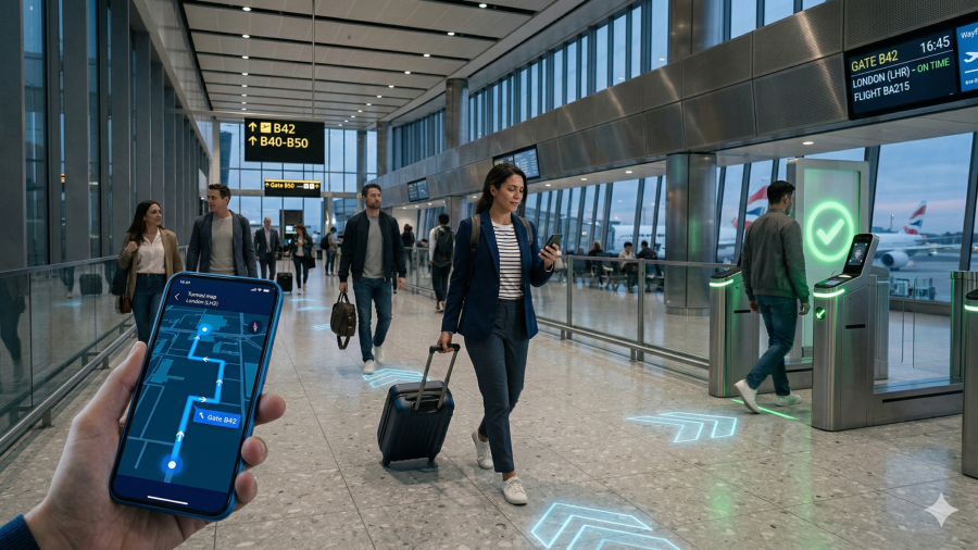
The aviation industry entered 2026 on a high. Biometric boarding is scaling fast, digital travel credentials are going mainstream, and the ACI World–Amadeus Technology Innovation Awards just recognized a new generation of airports building fully contactless passenger journeys. Facial recognition now links a passenger’s identity to their boarding pass, bag tag, and lounge access in a single token — no paper needed.

But here’s the uncomfortable truth the biometric conversation keeps ignoring: verifying who a passenger is does not tell them where to go.

Q: After biometric check-in, what’s the biggest remaining airport friction? A: Navigation. According to Mappedin’s 2026 State of Venue Experience report, 53% of venue visitors still experience wayfinding problems. Biometrics verify identity — but they don’t tell you where Gate B47 is. Digital indoor maps close that gap.

Biometrics Solve Identity, Not Navigation

Single-token biometric journeys are impressive. A passenger walks through check-in, bag drop, security, lounge access, and boarding with their face as their only credential. The friction at each checkpoint drops dramatically.

But between those checkpoints, passengers are on their own. And the data suggests that’s a problem. Mappedin’s research, which surveyed nearly 500 venue visitors across North America, found that more than half encountered at least one navigation problem in the past six months — and that 77% of all visitors now actively use digital tools to find their way. Only 23% still rely solely on physical signage or staff assistance.

For airports investing millions in biometric infrastructure, ignoring the space between the scanners is a strategic blind spot.

The Gap Between Security and the Gate Is a Revenue Leak

Navigation friction doesn’t just frustrate passengers. It costs airports money.

Every minute a traveler spends searching for their gate is a minute they’re not browsing duty-free, ordering a meal, or discovering a lounge. Mappedin’s data reveals that 50% of venue visits are discovery-oriented — visitors arrive without a specific purchase in mind, open to browsing, dining, and exploring. If they can’t find what’s available, they won’t spend.

Airport retail and food-and-beverage concessions depend on passenger dwell time. When navigation fails, dwell time drops, and so does ancillary revenue — the income stream airports increasingly rely on to offset tight operational margins.

Digital Wayfinding: The Missing Layer

The airports leading the next phase of passenger experience aren’t just deploying biometrics. They’re layering digital wayfinding on top — connecting identity verification to real-time indoor navigation.

The most effective implementations share three characteristics. They are instant, requiring no app download and working through a simple QR code scan that opens an interactive map in the passenger’s browser. They are integrated, connecting wayfinding to digital signage, flight information systems, and retail discovery. And they are data-generating, capturing anonymized foot traffic and flow patterns that feed into operational planning and digital twin systems.

This approach turns wayfinding from a passive signage exercise into active infrastructure — the kind that reduces staff directional queries, increases retail visibility, and gives airport operators the indoor data they’ve been missing.

From Concept to Deployment

This isn’t theoretical. Airports across the GCC and beyond are already deploying QR-based indoor navigation that gives passengers turn-by-turn directions from any terminal touchpoint, with zero downloads and multilingual support.

It’s the kind of solution that fills the post-biometric gap — connecting the identity layer airports have invested in to the navigation layer passengers actually need.

The Bottom Line

Biometric boarding is a breakthrough. But breakthroughs create new expectations. Once a passenger breezes through security without touching a document, they expect the rest of the journey to be just as seamless.

The airports that win in 2026 won’t be the ones with the best scanners. They’ll be the ones where no passenger ever has to ask, “Which way to Gate B47?”

data-5

Wayfinding for Complex Venues

We have all been there. You step off a flight into a sprawling, unfamiliar terminal, your phone is on 4% battery, and your connecting gate is technically in a different zip code. Or perhaps you are standing in the lobby of a mega-hospital, clutching a referral slip, staring at a static wall directory that looks more like a circuit board than a map.

The resulting feeling is a mix of panic and frustration known as “spatial anxiety.”

For years, architects focused on the structural integrity and aesthetic grandeur of buildings. But today, the focus has shifted to the experience of the human inside the box. In complex venues—sprawling airports, multi-wing hospitals, labyrinthine malls, and resort-style hotels—the ability to navigate intuitively isn’t a luxury. It is the very foundation of the visitor experience.

When we talk about wayfinding, we aren’t just talking about signage. We are talking about the seamless intersection of psychology, design, and technology that helps us answer the two most primal questions we ask when entering a new space: Where am I? and How do I get to where I want to be?

The Psychology of Getting Lost

To understand why wayfinding matters, we first have to appreciate how stressful it is to be lost. When a visitor enters a complex venue, their brain is immediately tasked with building a “cognitive map.” In a small coffee shop, this takes seconds. In a 2-million-square-foot facility, it is impossible without help.

When navigation fails, cortisol levels spike. A frustrated visitor in a mall stops shopping and leaves. A confused traveler in an airport misses a flight. A stressed patient in a hospital arrives at their appointment in a state of agitation, complicating care.

Good wayfinding reduces this cognitive load. It acts as an invisible hand, guiding visitors so they can focus on why they are there—whether that’s to board a plane, buy a gift, or heal.

Moving Beyond the Static Sign

Historically, the solution to navigation was the placard. Arrows pointing left, right, and forward. While physical signage remains vital, the sheer complexity of modern venues has rendered static signs insufficient. They can’t update in real-time, they can’t speak your language, and they can’t guide you from a specific “You Are Here” point to a moving target.

This is where the interactive digital map has revolutionized the industry.

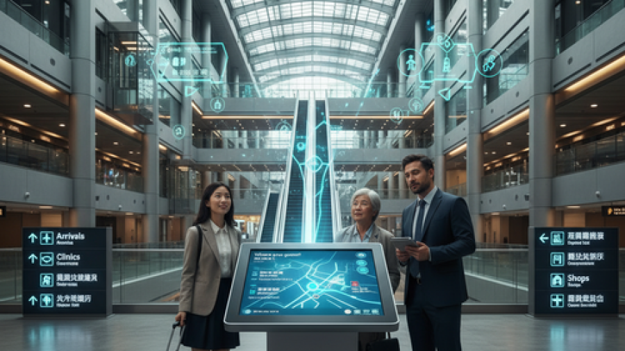
Imagine entering a massive convention center hotel. Instead of asking a busy concierge for directions to the keynote hall, you scan a QR code or approach a kiosk. You get a blue-dot navigation experience—similar to GPS for your car, but for the indoors. It’s friendly, it’s instant, and it empowers the user.

Digital wayfinding bridges the gap between the physical environment and the digital expectation. We live our lives on screens; expecting visitors to navigate complex physical spaces without digital aid feels increasingly archaic.

Context Matters: The Stakes of Navigation

While the technology is universal, the application differs wildly depending on the venue. The “why” changes the “how.”

1. Hospitals: Wayfinding as Empathy
In hospitals, visitors are often under high stress. They are worried about a loved one or their own health. Getting lost here isn’t just an inconvenience; it can feel traumatic. Effective wayfinding in healthcare is an act of empathy. It requires clear, reassuring cues and digital systems that account for mobility issues, ensuring the shortest, most accessible routes to elevators and clinics.

2. Airports: The Efficiency Engine
For airports, time is the currency. A lost passenger causes delays. The goal here is velocity and flow. Digital maps in airports are now integrating live data—showing not just where the gate is, but how long it takes to walk there, where the nearest restroom is along the path, and real-time flight updates. It turns a chaotic sprint into a managed journey.

3. Malls: The Discovery Tool
In malls, the goal isn’t just getting from A to B; it’s about discovery. Wayfinding here serves a dual purpose: utility and exploration. An interactive map can guide a shopper to a specific shoe store, but it can also highlight a coffee shop on the way or notify them of a pop-up event nearby. It transforms navigation into engagement.

The Future is Friendly

The beauty of modern wayfinding technology is that it doesn’t need to feel “high-tech.” It just needs to work. The best systems are the ones you barely notice because they feel so natural.

As venues continue to grow in size and complexity, the gap between a terrible experience and a delightful one will often come down to navigation. By prioritizing smart, friendly, and accessible wayfinding strategies, facility managers aren’t just managing traffic—they are curating confidence.

In the end, a visitor who knows where they are going is a visitor who is happy to be there.